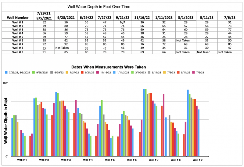
The Village has been taking periodic water elevations measurements of nine select private wells to create elevation baselines of seasonal changes in the aquifer (a body of permeable rock which can contain or transmit groundwater.) This data can be used in conjunction with other information, such as weather data, to help forecast aquifer performance during draught periods. Having this information available will help with making decisions for circumstances that may impact the users of the aquifer.
The chart below shows that the changes in levels are fairly consistent between wells. Differences in levels between wells during the same period is attributable to different ground elevations at each site.